When you fly somewhere, it’s all about getting to your destination as quickly as possible. You step on a plane at one end and leave the plane at the other end. Whereas when you drive to your destination, you get to see and experience what is along the way, and maybe even take a detour or two.
When driving between Melbourne and Adelaide, there are a quite a few route options available, however we will cover three here – the most direct, along the coast and the route up north.
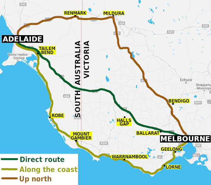
1. Direct route – Western Highway & Dukes Highway
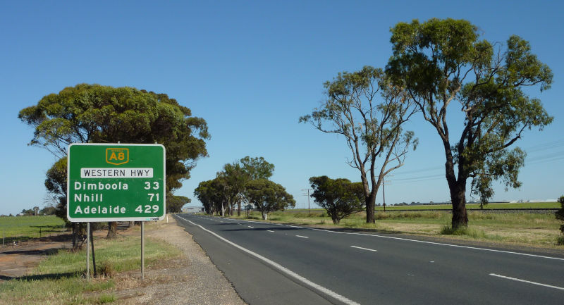
The inland route is the quickest and shortest, thus it is also used by road transport operators moving goods between Melbourne and Adelaide.
Follow the Western Freeway out of Melbourne, and maybe get off the freeway and visit Ballarat – Victoria’s third largest city which has a rich history dating back to its prosperous days during the Gold Rush era.
Nature lovers will want to turn off the Western Highway at Ararat and detour to Halls Gap which lies within the famous Grampians National Park. There are waterfalls to discover, challenging hiking trails, stunning mountain views, lots of native wildlife and rich Aboriginal heritage that dates back many thousands of years.
Approximately 440 kilometres from Melbourne, the Western Highway crosses the state border into South Australia and the road becomes known as the Dukes Highway.
Follow the Dukes Highway to Tailem Bend – an attractive road junction town which overlooks the lower reaches of the mighty Murray River.
Follow the Princes Highway to Murray Bridge – also set on the Murray River and home to a large fleet of houseboats.
A 75 kilometre drive along the South Eastern Freeway will then take you into Adelaide, concluding the 726 kilometre road trip.
2. Along the coast – Great Ocean Road
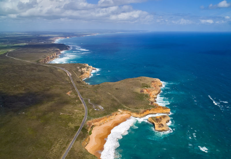
Water lovers with time to spare should take the coastal route to Adelaide. It adds about 300 kilometres to the journey and significantly extra time due to some section of windy roads and passing through many coastal towns.
Follow the Princes Freeway out of Melbourne to Victoria’s second largest city of Geelong, which overlooks Corio Bay. From there, head south to Torquay which is the official start of the internationally recognised Great Ocean Road.
The Great Ocean Road is a spectacular coastal drive where you can enjoy panoramic coastal scenery, see stunning rock formations such as the 12 Apostles, explore lush rainforests and visit seaside communities which welcome travellers and holidaymakers.
The Great Ocean Road ends at the city of Warrnambool. Head west along the Princes Highway to the historic fishing village of Port Fairy and onto the deep sea port of Portland which was the site of Victoria’s first permanent settlement. Leave the highway at Portland and follow Portland – Nelson Road to the town of Nelson – a small village set on the majestic Glenelg River, within a stone’s throw of the state border with South Australia.
Follow Glenelg River Road across the border and to the large regional city of Mount Gambier. This geological hotspot is famous for its Blue Lake and stunning sinkholes. Take a 28 kilometre detour down to the coast to Port MacDonnell – once a busy shipping port, but now a quiet and charming village.
After leaving Mount Gambier, turn off the Princes Highway at Millicent and travel along the Southern Ports Highway to explore the coastal holiday towns along South Australia’s Limestone Coast. Check out Beachport, the ever popular holiday town of Robe and also Kingston SE with its Big Lobster.
Rejoining the Princes Highway, the coastal route traverses the Coorong National Park – internationally recognised wetlands with salty lagoons and gorgeous sandy beaches. Pass through Meningie, which is set on the shores of Lake Albert, before reaching the Murray River at Tailem Bend and completing the final leg of the journey to Adelaide.
3. Up north – Calder Highway & Sturt Highway
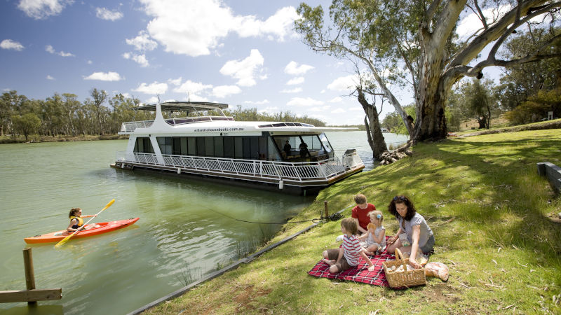
In complete contrast to the coastal route, the northern route traverses the more remote parts of Victoria and South Australia, adding around 200 kilometres to the journey.
Follow the Calder Freeway out of Melbourne and through the Macedon Ranges to Bendigo. Like Ballarat, this city thrived during Victoria’s Gold Rush days, leaving a lasting legacy of opulence and wealth.
Heading out of Bendigo on the Calder Highway takes you through a number of rural communities and through Victoria’s vast Mallee region which is home to huge farms that grow grain and other crops.
The Calder Highway ends in the far north-west corner of Victoria at the city of Mildura. Set on the Murray River and one of the warmest spots in the state, Mildura is a popular holiday destination, particularly for those who enjoy water activities on the river, and it is surrounded by vast wineries and fruit farms.
From Mildura, head west along the Sturt Highway, across the state border into South Australia, arriving at Renmark. Renmark is the gateway to South Australia’s Riverland region, with its Mediterranean climate creating a rich fruit growing area with irrigation provided by the Murray River. Visit the attractive river-front towns of Berri, Loxton and Waikerie.
The Sturt Highway continues west and passes through the northern section of the Barossa Valley at Nuriootpa. The Barossa Valley is, of course, one of Australia’s most famous wine region where you will find the biggest names in the wine industry.
From Nuriootpa, it is a 72 kilometre drive to Adelaide, however you may want to take the more scenic route along Barossa Valley Way through the charming grape growing towns of Tanunda and Lyndoch.
